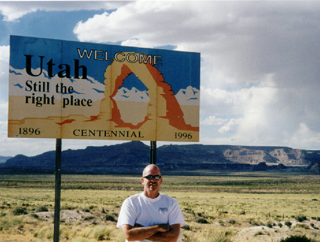
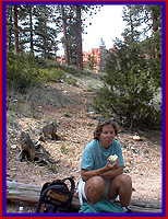
Sunday May 30th
Our first scenic attraction today was Wupatki and Sunset Crater Volcano National Monuments. Uh-oh, as we pulled up to the entrance, there were a line of cars waiting to get into the park. This is an omen of things to come as summer approaches so, we better learn to enjoy waiting in line. We have been spoiled so far with the sparse crowds. Since this area is a National Monument, we were able to use the Golden Eagle pass we bought at Grand Canyon. The pass is good for entrance to all National Parks for a year. We can't wait to see the beauty that is waiting for us at these national treasures.
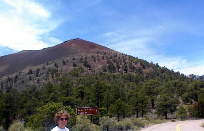
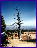
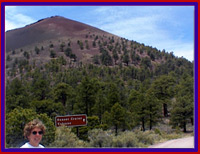 Sunset Crater was formed by explosive eruptions in Ad 1064-65. The molten lava erupting from the center of the volcano piled up to create the cone-like formation. The black cinder cone, which is over 1,000 feet high, loomed on the horizon almost as soon as we entered the park. The ash that spewed from the volcano hundreds of years ago is spread around for miles making the landscape look like it was neatly paved. Surprisingly, many species of plants and animals thrive here. On the very top of Sunset Crater, red and yellow oxidized particles vividly formed a permanent "sunset" on the rim.
What was really neat is it that Mount Humphries (highest mountain in Arizona) was also visible from the park. I love this mountain. It just looks so friendly with its snow covered peaks. As the road twisted and turned through the park, Mount Humphries kept popping into view much to our delight. I want to come back some day and climb it. (There is a hiking trail. Hey Barry, are you with me?)
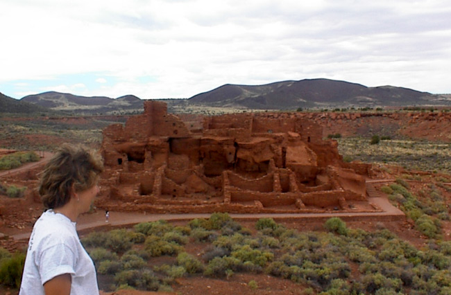
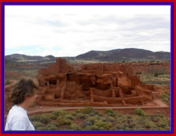 Our next stop within the same park was Wupatki which is a large ruin of the Sinagua Indians of the Wupatki pueblo. Over 200 people had lived in the apartment-like dwelling, one of the largest pueblo ruins around. This pueblo was complete with an auditorium and a ballcourt for recreation.
It is surmised that neighboring tribes, less then a days travel away, would gather to play ball. Like dopes, we forgot to pick up a trail guide, but because of the Indian Museums we had been in previously, we could recognize things.
Our next stop within the same park was Wupatki which is a large ruin of the Sinagua Indians of the Wupatki pueblo. Over 200 people had lived in the apartment-like dwelling, one of the largest pueblo ruins around. This pueblo was complete with an auditorium and a ballcourt for recreation.
It is surmised that neighboring tribes, less then a days travel away, would gather to play ball. Like dopes, we forgot to pick up a trail guide, but because of the Indian Museums we had been in previously, we could recognize things.
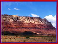 As we were leaving the park, straight ahead the painted dessert came into view. Exquisite shades of pink, red and blue pastels were beautifully laid out on the horizon. These hazy pastel stripes appeared to meet the sky and we were taken with the beauty laid out before us as we stared through the windshield. This was in such contrast from the stark black volcanic ash area that we had just viewed.
The scenery in the southwest has to contain some of the most diverse panoramas in the United States. Everything we have seen is beautiful and unique in its own way. The view is constantly changing and always amazing.
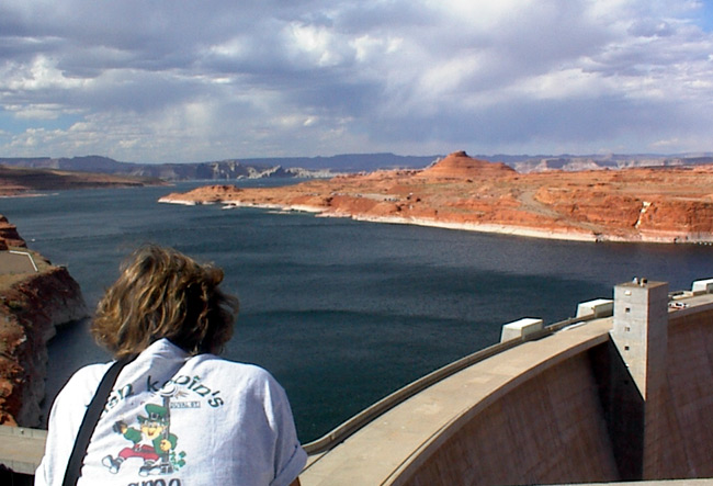
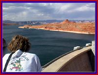
The next scenic wonder we saw was man-made. Lake Powell, an enormous lake that is over 500 feet deep in places, was created by the building of the Glen Canyon Dam. The purpose of the dam was two-fold. First to control water flow of the Colorado River and second to generate power.
 Construction on the Dam was started in 1956 and not completed until 1963. 400,000 buckets of concrete, each holding 24 tons was used.
It took 17 years for Lake Powell to fill. Today this area is used for boating and hiking. There are over 90 finger
canyons to explore by boat within the lake. Sandstone formations provide a stunning backdrop to Lake Powell which has
Construction on the Dam was started in 1956 and not completed until 1963. 400,000 buckets of concrete, each holding 24 tons was used.
It took 17 years for Lake Powell to fill. Today this area is used for boating and hiking. There are over 90 finger
canyons to explore by boat within the lake. Sandstone formations provide a stunning backdrop to Lake Powell which has
 more shoreline than the entire West Coast of the continental United States. That's a big lake!
The Glen Canyon Bridge, at 700 feet above the river, is the second highest steel arch bridge in the world. Before the bridge was completed in 1959, construction crews had to drive 200 miles around the canyon to get from one side to another. The bridge was actually constructed in California, disassembled in 2 pieces and half was transported to each side of the canyon. Amazing!
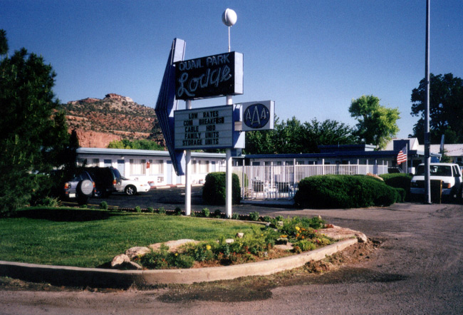
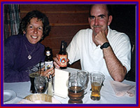
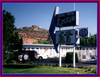 Our rest stop for the evening is Kanab, Utah. The Ridings Quail Park Lodge had Fred a little worried. He was afraid it was one of my "bargain bookings". The majority of the hotels in Kanab are only 2 star and my pick turned out to be quite comfortable. However, our dinner at the Chef Palace was disgusting. We both ordered the hot turkey sandwich with mashed potatoes. The potatoes were from a box and the turkey was from a package. The only person I know who prefers boxed mashed potatoes is Roger Petrilli. Yuk!
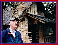
Across the street from our hotel was the highlight of Kanab. Called the Western Movie Set, it is a re-creation of a western town complete with saloon, wagon train and graveyard. Kanab, as a mini Hollywood, is the film sight for many western movies including Billy the Kid and Arabian Nights.
Back to Journal Index
Monday May 31st
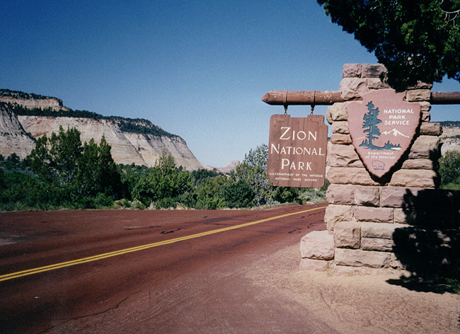
Zion National Monument
Happy Memorial Day! Is everyone having a picnic and cooking burgers?
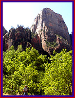
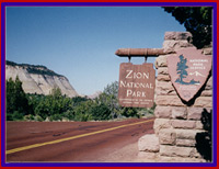 Crazy as it sounds to do on Memorial Day, we visited Zion National Monument. The roads in Zion were created many years ago and the parking is inadequate for the amount of current visitors (2 million per year). We encountered full parking lots in many of the hiking spots and the BK is not one to squeeze in a small space.
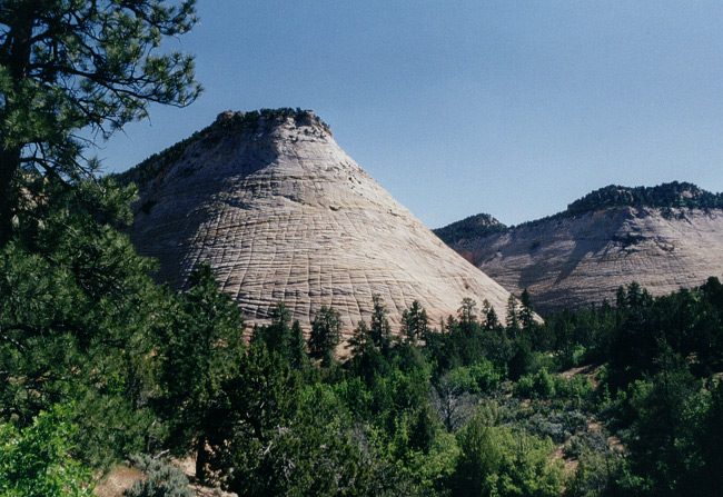
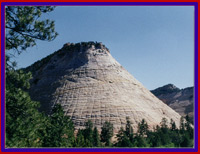 Our first look was at Checkerboard Mesa which literally looked like a checkerboard. Sand particles in harmony with years of erosion etched vertical and horizontal lines in the rock. Just beyond checkerboard mesa, the same forces of nature etched lines in round rocks that resembled large wrinkles in a big fat belly.
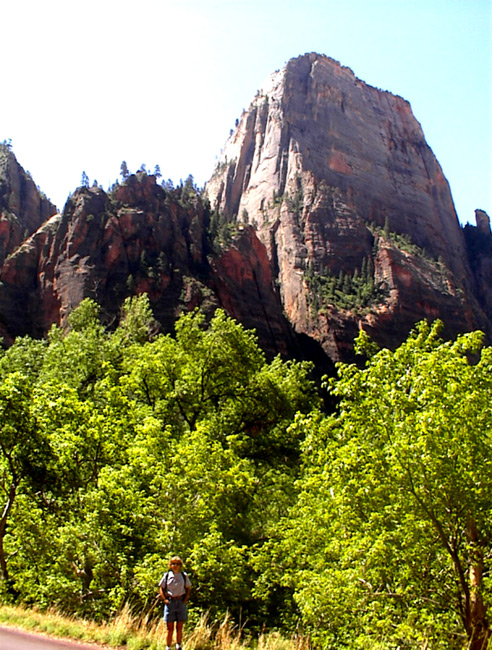
As we drove through the park, once again we were looking around in amazement. A large tunnel, cut through the rock, led us down into the canyon. Rock ridges over 1,000 feet high surrounded us. Trees and plants grew out of the most unlikely spaces in the rock.
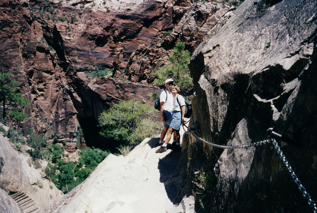
After a brief stop at the visitors center to fill up our water bottles, we headed out to the Hidden Canyon trail. The trail started out easy on a paved walkway, but was a continous up-hill climb. We were soon huffing and puffing, but kept a steady pace.
About halfway up, the trail hugs the canyon wall with only a chain drilled into the rock as a steadying
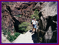 force. The other side drops straight down, way down. Fred, who claims he is afraid of heights, was very brave. He simply did not look down. I did and it was dizzying but exhilerating.
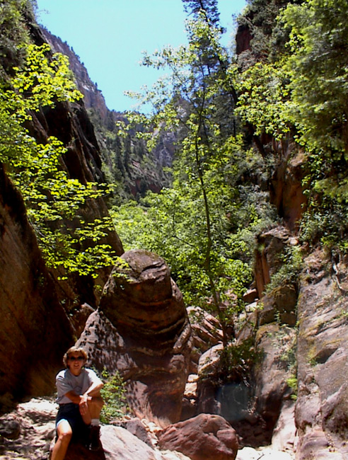
The maintained trail ended after 1 mile and we continued along a rocky path.
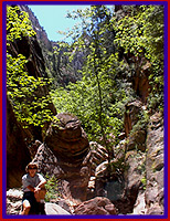 Here the trail eventually goes down into the "hidden canyon". At times we felt like we were walking on the beach, there was so much sand on the canyon floor. We alternated between hiking in the sand and scrambling over and around rock formations. We were doing great until Fred's foot slipped. He gave both of us a scare. Sand from erosion of the sandstone covered the rocks we were climbing over and made them extremely slippery. After that, I had some trouble but finally made it through another scary spot. However, another 1/2 mile of strenuous scrambling and we were done. Our sensible side, or maybe it was the shaky legs and sore ankles, got the better of us and we turned back. It was indeed time.
 Back at the trail head, we just had to hike another easy trail to Weeping Rock. Even though we were tired, it was worth it. The layers of sediment above somehow hold and release water and it rains down over the rock. It was an awesome sight.
One more stop on the way out at the easy 1 mile Canyon Overlook trail, provided great views of the lower Zion Canyon. We were beat and ready to head to our hotel for the evening.
As we left the park, the lowering sun cast shadows over the rocks making the scene look completely different than the drive in. Back on the highway, in the distance, the Pink Coral Sand Dunes were visible. The setting sun made them appear brilliant. Continuing down the road, we started climbing to higher elevations and ended up in some kind of lush green valley. It
 felt like we were on top of the world. I know I said this before, but we just can't get over the awe we feel at the astounding beauty of the ever changing landscape of the southwest.
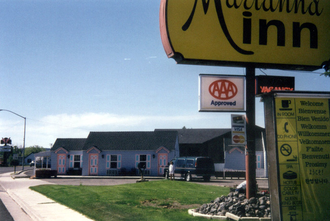
Our bed for the night was at the Marianne Inn in Panguitch, Utah. For a 1-star, (Fred couldn't believe I booked a one-star and I was keeping my fingers crossed) we got lucky. Dinner at Grandma Tina's, a delicious Italian restaurant, was much better than last night.
Back to Journal Index
Tuesday June 1st
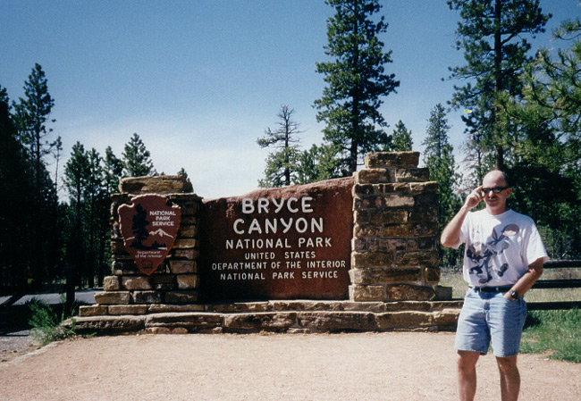
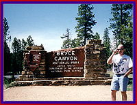
Bryce Canyon
Wow June already. It's hard to believe we have been on the road for two months. This trip has turned out even better then we imagined way back in February and March when we were sitting in our dining room with AAA books spread out booking our reservations.
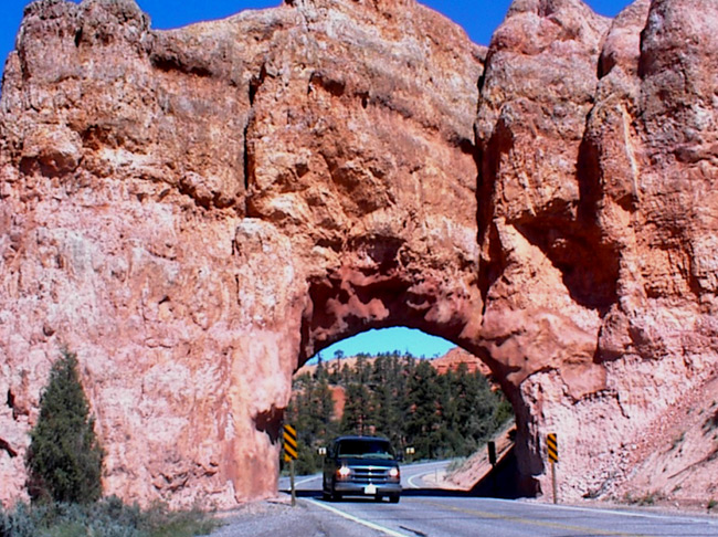
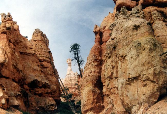
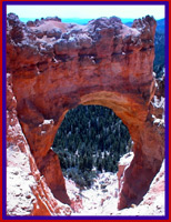
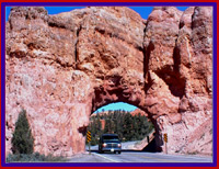 Today was one of our shortest drives of the trip. Panguitch to Bryce Canyon is only 40 miles. However, before we reached Bryce we were treated to Red Canyon which was a delightful sneak preview of things to come.
Slabs of red rock, all shapes and sizes, piled high on top of each other came into view on both sides of the road. Two arch-like tunnels through the rocks provided passage for the Big Kahuna. We were fascinated by this mini canyon and giddy with anticipation of things to come. Each National Park is a new and exciting adventure.
Today was one of our shortest drives of the trip. Panguitch to Bryce Canyon is only 40 miles. However, before we reached Bryce we were treated to Red Canyon which was a delightful sneak preview of things to come.
Slabs of red rock, all shapes and sizes, piled high on top of each other came into view on both sides of the road. Two arch-like tunnels through the rocks provided passage for the Big Kahuna. We were fascinated by this mini canyon and giddy with anticipation of things to come. Each National Park is a new and exciting adventure.
 In no time, we were at the visitors center checking out the interesting displays. This was the best visitor center so far. Of particular interest was the smog display, the wildlife display and the life zone display. More about those later.
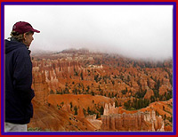
After talking to the ranger, we decided to drive the 18 miles from the Visitors Center to Rainbow Point which is an elevation change of 1,000 feet. Bryce Canyon park contains three life zones. Our drive through the life zones started at the entrance beginning with the Upper Sonoran pinyon and juniper trees while at the Visitor Center, the Transition zone is dominated by towering ponderesa pines and finally as we continued to climb into the Canadian life zone the forest gave way to fir, spruce and aspen trees. (A quick little geography lesson) Needless to say the views were tremendous.
From Yovimpa Point, we could clearly see for what must have been one hundred miles. We were reminded of the display at
 the Visitors Center which showed how due to smog and pollution,
San Francisco visibility is only 15 miles, while Yosemite is 50 miles and Bryce Canyon is 100 miles. We were breathing the cleanest and purist air around.
the Visitors Center which showed how due to smog and pollution,
San Francisco visibility is only 15 miles, while Yosemite is 50 miles and Bryce Canyon is 100 miles. We were breathing the cleanest and purist air around.
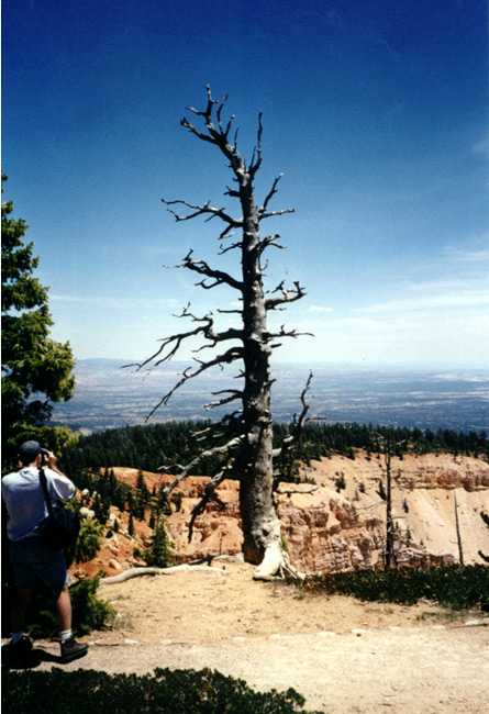
The Bristlecone loop trail, 1 mile long, took us to the oldest tree in the park plus various breathtaking lookout points. From one of these vantage points, we could see The Pink Cliffs which are the top step of the Grand Staircase. Here's another geography lesson that I found fascinating.
In order, the Grand Staircase descends from Pink Grey, White, Vermillion and Chocolate cliffs. The top step is where we were standing. 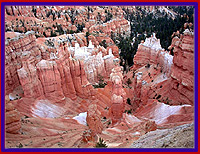 Zion's top level of rock is the same as the bottom of Bryce, while the Grand Canyon's top level of rock is the bottom of Zion. We had been on three steps of the staircase.
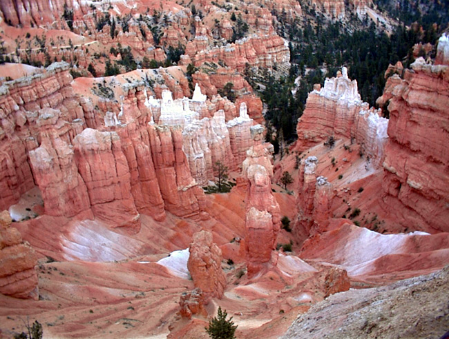
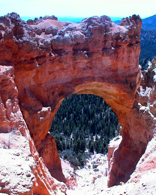
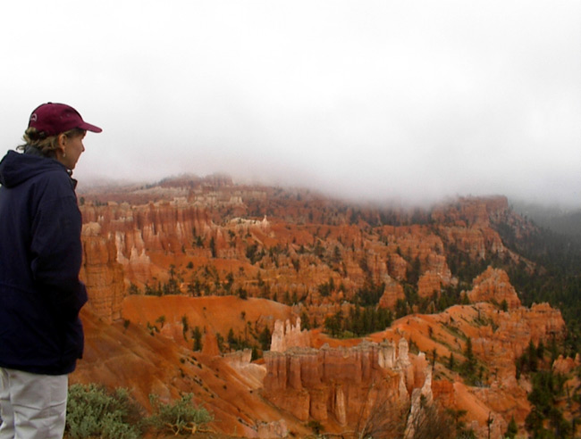
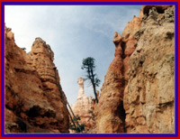
Bryce Canyon is not really a canyon, but a series of amphitheaters carved out of the Paunsaugunt Plateau. The Indian legend says that the Towhenanungwa lived in the canyon in the form of animals, lizards and birds and they were so bad that the Coyote turned them all into rocks. You can see them now, all turned into rocks, some standing in rows, some sitting down, some holding onto others. You can see their faces, with paint on them just as they were before they became rocks.
Actually the rocks at Bryce are limestone. The continuing cycle of freezing and thawing changes the limestone rock forming hoodoos. The hoodoos do indeed look like statues, some appearing to be in conversation with each other. Others look like castles with the kings knights protecting them.
 Hoodoos are rock pinnacles and spires that have been left standing by the forces of erosion at work on the limestone. Wind and water cause harder and softer layers of limestone to erode at various rates. As the softer layers continue to erode, the hoodoos collapse and reform.
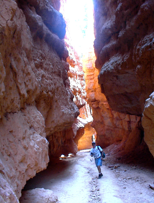
The hike we chose, the Navajo Loop trail turned out to exceed our wildest expectations. The trail leads down a series of steep switchbacks into the hoodoos. Once again we were utterly amazed. At every turn in the trail another gorgeous picture presented itself.
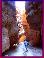 The limestone rock, tinted red by oxidized iron particles, stood in splendid glory all around us. The bottom of the trail culminated at Wall Street, a rock formation with walls so sheer and tall that we could barely see the sky. Words cannot begin to describe how we felt as we looked around.
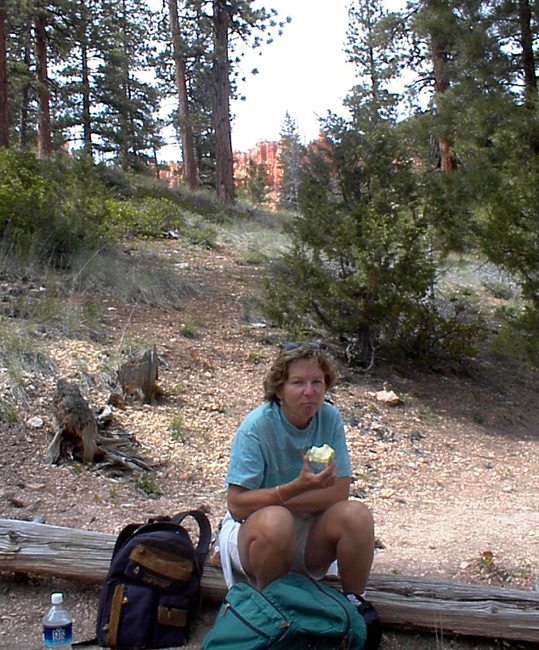
 We continued onto the Queen's Garden Trail through the woods. We stopped along the trail to have a snack and were immediately joined by two chipmunks. Chip and Dale were adorable as they scampered around entertaining us with their antics.
 This part of the trail was not heavily traveled so we were alone with the beauty and silence. From our seat on a log, we could look up and stare at the magnificent hoodoos. They looked like pieces from the game of Blockhead. Only these square, rectangle and circular pieces weighed 20 tons each.
Time to head up the trail as the sun was starting to set. The trip up was tough but the views were just as impressive and we paused often to look around.
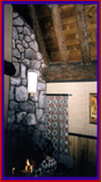
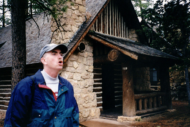
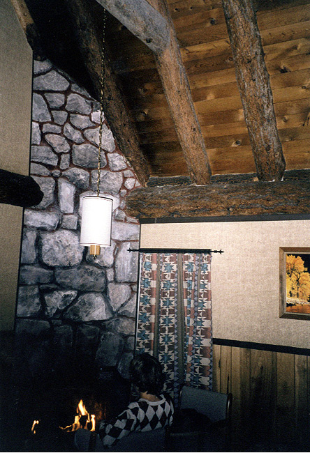
 After a wonderful dinner in the lodge and some local Utah microbrews, we headed back to our room, a rustic A framed log cabin complete with fireplace. It had been a near perfect day.
The Navajo loop trail and the incredible beauty of what we had viewed today prompted us to decide to rise tomorrow morning at 5:30 AM to go down to the rim and watch the sunrise. Then we were going to hike the trail again to see the hoodoos in the early morning light after which we would have breakfast in the lodge. What an incredible morning we have planned.
Back to Journal Index
Wednesday June 2nd
Bryce Canyon to St. George
 We awoke to the sound of rain and no electricity in the cabin. There would be no sunrise this morning. We packed up and walked down to the rim to take one last look at the hoodoos. Thank goodness we had gotten in early yesterday and been able to hike and see the park because today it was nasty. We really wanted to hike down the Navajo Loop trail again because it had made such an impression on us yesterday, but thought better of it. Hiking back up in the pouring rain would not be much fun. However, Bryce Canyon is definately a must return destination for us and we have a date for the future to see a sunrise there.
This morning we pulled a Griswald(see 1 below.) at Fairyland Point. By now it was pouring rain and as pulled into the view point we were hoping to do a drive-by. However, we had to park and get out of the car to see the view. We got out, walked up to the edge, snapped a photo and were back in the car in 5.2 seconds.
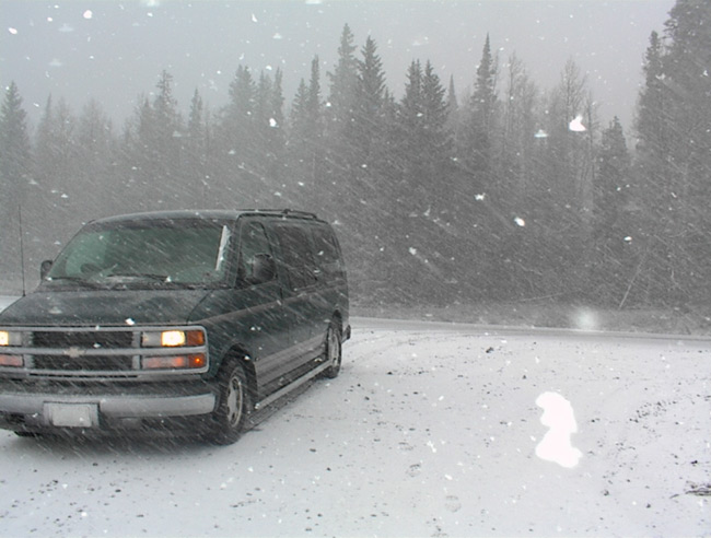
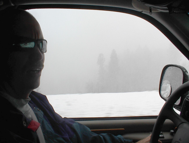
This is unbelievable. It has actually started to snow. As the road climbed to a higher elevation, the rain changed to snow. The visibility can't be more than 50 feet. We are in a blizzard in June! The snow is coming fast and furious, laying on the road and blanketing the pine trees.
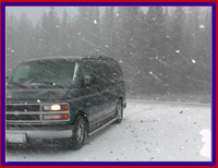 We have to stop and take a picture, this is so incredible. As we continue to climb, the snow is getting heavier. The Big Kahuna is sliding. We are crawling at 25 miles per hour. And, still we continue to climb higher. We are on our way to Cedar Breaks National Monument. Finally, we reach the visitors center, but it is closed. We never dreamt when we read "closed in winter" on the brochure that it meant June. We pass several "Scenic Points" but funny they all look the same-snowy.
The road is now starting to descend. Uh-oh, this is worse. The Big Kahuna is not very graceful in snow. On one side of us is a hill going straight up, on the other side a sheer cliff drops straight down. We are in low gear and only going 10 miles per hour and getting very nervous. Come on BK, hold on. All of sudden people are pulled off to the side of the road. A truck pulling a trailer has slid across and off the road on our side. The sheriff is there so we slowly keep moving. Oh shit!
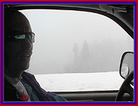 As we begin to slide off to the right, we realize that the road surface is no longer snow, but ice. Fred is fighting for control of the BK. We are scared now. His knuckles are white on the steering wheel and I am holding on for dear life. In my mind, I see us going over the cliff and in stunt man style bailing out just as the BK plunges 1,000 feet taking all of our stuff along. Of course, at this point in time, I do not share my day-mare with Fred. After several harrowing attempts, Fred gets the BK back on the road. Slowly we crawl along and after what seems like forever, we descend into lower elevations and the snow changes back to rain. What a weird experience.
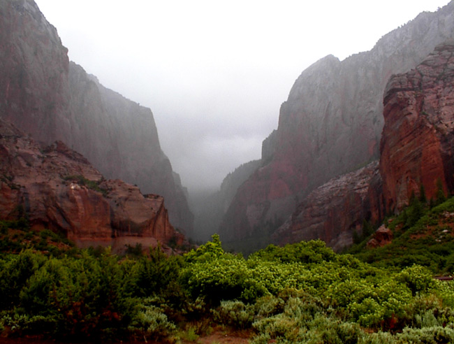
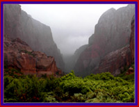 We stopped at the upper end of Zion and drove the 5 mile scenic trail. Huge finger canyons loomed behind the fog. Visibility was limited but the view was incredibly pretty in a shadowy sort of way.
St. George, our destination for the night is our last stop in Utah for awhile.
(1)A Griswald is from the movie National Lampoon Vacation where the Griswalds had planned to see so many sights, all they had time to do was stop and take a picture.
|